
Metro
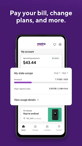
Screenshots
Description
About Metro: Subway Navigation Feature – Your Intelligent Urban Transit Companion
Metro is a dedicated public transportation navigation application, specifically optimized for subway systems in major cities worldwide. It provides users with accurate, real-time route planning, station information, and transit guidance, aiming to simplify urban travel. By integrating detailed subway maps, schedules, and service alerts, Metro transforms complex transit networks into intuitive, user-friendly pathways. Whether for daily commutes or exploring a new city, the app serves as a reliable digital guide, helping passengers navigate underground networks efficiently and with confidence.
Chapter 1: Function
The core functionality of Metro revolves around comprehensive subway navigation and real-time information. The app features interactive maps for numerous cities, allowing users to visually plot their journey from origin to destination station. It calculates optimal routes based on current schedules, providing step-by-step directions including transfer points, estimated travel time, and fare indications where available. A key function is its offline capability; users can download city maps for use without an internet connection. The app also delivers live service updates, notifying users of delays, line closures, or scheduled maintenance. Additionally, it includes practical tools like station exit guides, platform layouts, and points of interest near stations, ensuring users can navigate both the subway system and its surrounding areas seamlessly.
Chapter 2: Value
Metro's primary value proposition lies in its specialized focus, reliability, and user-centric design, offering distinct advantages over generic map applications. By concentrating solely on subway and urban rail systems, it provides a depth of detail—such as precise station entrances, restroom locations, and elevator access—that general apps often lack. This specialization ensures higher accuracy for transit-specific planning. A significant advantage is its global coverage coupled with robust offline functionality, making it an indispensable tool for international travelers who wish to avoid costly data roaming charges. The app saves users time and reduces travel anxiety by offering clear, unambiguous instructions and proactive service alerts, enabling better journey planning and contingency management. Its clean, ad-light interface prioritizes functionality and ease of use, allowing passengers to access critical information quickly, even in crowded or time-pressured environments. Furthermore, by promoting the use of public transit, Metro aligns with sustainable urban mobility goals, providing value not only to individual users but also to the broader urban ecosystem. Its continuous updates and expansion to new cities ensure its utility grows alongside global urban transit networks.
Chapter 3: Scenarios
Metro primarily serves two broad user groups: daily commuters in metropolitan areas and travelers or tourists visiting new cities. For the daily commuter, the app is a vital tool for routine travel, used to check for morning service disruptions, find the quickest alternative route in case of delays, or time an evening departure perfectly. It turns a potentially stressful commute into a predictable and managed part of the day. For tourists and business travelers, Metro acts as a personal transit guide, demystifying unfamiliar subway systems. A visitor to Paris, London, Tokyo, or New York can confidently navigate from the airport to their hotel, plan day trips to major attractions, and explore the city like a local, all by relying on the app's detailed maps and instructions. Common use cases include planning a multi-stop sightseeing itinerary, finding the nearest subway station in an unfamiliar neighborhood, verifying the last train time for a late-night return, or simply understanding which subway car to board for the most efficient exit at the destination station. In essence, Metro is tailored for any individual seeking efficient, confident, and intelligent navigation through the world's underground rail networks.
Uninstall Instructions
For step-by-step guidance on how to safely remove this application from your device, please refer to our 《Uninstall Instructions》 document.
Pros
- live subway arrival times via crowd-sourced data
- offline navigation for underground transit systems
- step-by-step guidance with platform and exit details
- integrates official schedules with real-time user reports
- minimal data usage due to efficient map design
Cons
- accuracy depends on local user network density
- coverage limited to major global metro cities
- no real-time integration in some official-restricted regions
- basic interface lacks advanced trip customization
- offline maps require manual regional updates
Frequently Asked Questions
What is Metro and what does it do?
Metro is a public transit navigation app designed for urban commuters. Its core function is providing real-time subway and light rail navigation, including route planning, schedule information, service alerts, and station details. The app helps users find the fastest or simplest routes between stations, estimate travel times, and check for any line disruptions or delays. It typically uses your current location or a manually entered start point to calculate journeys.
Is Metro free to use, or does it have in-app purchases?
Metro is a free application to download and use for basic route planning and schedule viewing. However, it may offer optional in-app purchases for premium features. These could include ad-free usage, offline map access for use without an internet connection, or more detailed real-time arrival data. The app itself does not require a subscription for its fundamental navigation services.
Which cities and transit systems does Metro support?
Metro's coverage is not universal and is limited to specific metropolitan areas and their transit authorities. The app typically supports major cities with established subway or metro rail networks. You need to check the app's description or official website for the current list of supported cities and systems, as this list is periodically updated when the app adds new data partnerships or geographic regions.
How accurate is the real-time arrival information in Metro?
The accuracy of real-time data in Metro depends entirely on the data feed provided by the local transit authority in each supported city. The app displays the information it receives from these official sources. While generally reliable, it may not reflect last-second delays or on-the-ground conditions. For the most critical planning, it's always advised to cross-check with official transit agency alerts for major service changes.
Can I use Metro for navigation without an internet connection?
Basic offline use is possible only if the app has a dedicated offline maps feature, which is often a premium, paid function. For standard, free usage, an active internet connection (cellular data or Wi-Fi) is required to load maps, search for routes, and retrieve real-time schedule and alert data. Without a connection, the app's core navigation functionality will be severely limited or unavailable.
App Info
Technical Info
Recommended For You

Beauty Camera: Sweet Camera
Beauty

imo video calls and chat HD
Communication

Yahoo Mail
Communication

Dual App - Web Scanner App
Communication

AI Outfits: Try on Clothes
Art & Design

Phone Dialer - Contacts
Communication

Fax.Plus - Send Fax from Phone
Business

Package Tracker - pkge Mobile
Business

MediBang Paint:Draw Art, Comic
Art & Design

Obd Mary – Car Scanner for ELM
Auto & Vehicles

Bitcoin Miner Cloud
Business

Threema. The Secure Messenger
Communication

TeamSpeak 3 - Voice Chat
Communication

Poster Maker - Flyer Maker
Art & Design

MySubaru
Auto & Vehicles

FaxCover Pro Create Cover Page
Business

Webfic - Fantastic Reading
Books & Reference

Holy Bible - KJV+Verse
Books & Reference

Perfect365 Makeup Photo Editor
Beauty

GoDaddy Studio: Create & Grow
Art & Design